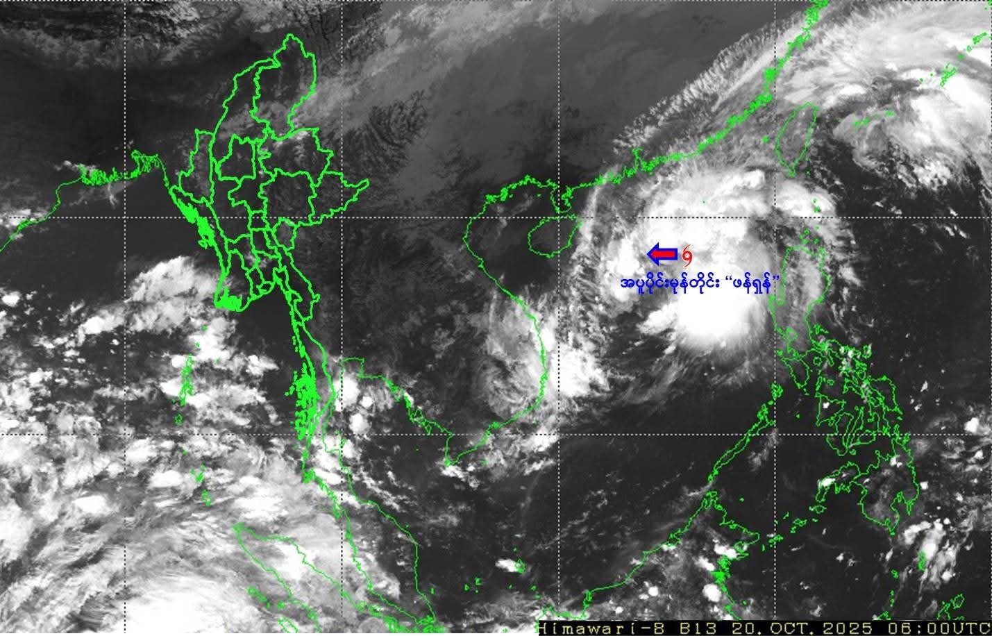
HEAVY winds and rains are forecast for the coming weeks due to the effects of the remnants of tropical cyclone Fengshen in the South China Sea and the formation of a strong low-pressure area in the Bay of Bengal.
Measurements at 12:30 am Myanmar time on 20 October showed that Fengshen moved west-northwest, and thereby could move westward, and is expected to become a strong storm within the next 15 hours, the Department of Meteorology and Hydrology said.
Due to a strong low-pressure area in the Bay of Bengal over the next seven days (20- 26 October), rain is forecast in Taninthayi Region, Mon, and Rakhine states and Magway/ Nay Pyi Taw with 7.1 to 8.7 inches, 6.3 to 7.9 inches and 5.1 to 7.1 inches, and 1.6 to 2.8 inches rainfall respectively.
“Overall, there are not many impacts by storms/low pressure zones in the coming weeks. In some areas, heavy rains can be severe, but not for long. People should be aware of sudden strong winds,” said meteorologist U Win Naing on 19 October.
On 21 October, rain certainty is 100 per cent in Shan (North), Ayeyawady, Taninthayi, Chin, Shan (South), Yangon, Mandalay, Bago, Sagaing, Kachin and Mon areas, the DMH announced at 2:00 pm on 20 October.
A strong wind and heavy rainfall with cumulonimbus clouds are forecast in Ayeyawady, Taninthayi and Rakhine and the DMH advises to take precautions as there is a possibility of lightning and hailstorms. — Htun Htun/ZN