By THAN HTUN (GEOSCIENCE MYANMAR)
EPISODE:20
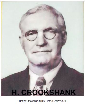
Henry Crookshank (1893- 1972) was born in Dublin the son of Charles Henry Crookshank and Elizabeth nee Stokes. His mother was related to the bacteriologist Adrian Stokes and archaeologist Margaret McNair Stokes. He was educated at St Columba’s College and then Trinity College, Dublin where he studied mathematics but World War I interrupted his studies. He joined the Dublin Fusiliers in 1914 and served in the Middle East and France.
He returned in 1918 to study engineering and joined the Geological Survey of India in 1929. The geological work began with oil surveys near Karachi and later studied sapphires in the Vizag area, and studied in the Satpura Gondwana Basin. Crookshank returned from the field on the 16th of May 1933. Appointed to officiate as Superintendent from the 27th of March to the 21st of September, 1933, and again from the 6th of October to the 22nd of December 1933. Placed in charge of the Southern Circle till the 22nd of December 1933. Crookshank served in the Northwest Frontier in the early 1940s but was shot in both legs and flown back to Rawalpindi. After recovering he was posted in charge of mica production in Rajputana.
He became the superintending geologist in 1944-45 and worked on the geology of the northern slopes of the Satpuras between the Moraud and Sher rivers. He was a fellow of the Indian National Science Academy. Almost a month before Clegg’s death, H Crookshank was asked telegraphically, when he was on the point of going on leave out of India, to take officiating charge of the post of Director, as Clegg had been suddenly taken ill. He continued to officiate in the post on Clegg’s death until he was able to avail himself of leave. Crookshank published his ‘Memoirs of the Geological Survey of India’ in 1936.
Geological Surveys of Burma Circle
Crookshank mainly worked in India and no record has been found of his geological activity in Burma, therefore, some geological surveys of Burma Circle, in the 1936-37 field season, during his term in GSI, could be described as follows:
From the 1st of April 1937, a separate Burma Geological Department was created, consisting of Messrs. Clegg, Bradshaw, and Dutt, who were placed on foreign service with the Government of Burma. During the field season, Mr Clegg continued the extension of his survey of the Mogok Stone Tract by examining various outcrops in sheets 93 B/4, 93 B/3, and 93 B/2 between Mandalay and Thabeikkyin, and then continued mapping in sheets 93 A/4 and A/8 north of Thabeikkyin.
Mandalay Hill
The area south of Thabeikkyin is included in La Touche’s map of the Northern Shan State but no attempt was made by La Touche to divide the rocks into the calcareous and granitic rocks which were known to exist. Mr Clegg found that all the isolated outcrops which protruded from the alluvium in the southern area consisted of either metamorphosed calcareous rocks, metamorphosed calcareous rocks intruded by granite, or solely granites. The exposures commence at Mandalay Hill, which consists essentially of crystalline limestones and diopside calciphyres, penetrated on the eastern flank by granite and pegmatite dykes. The granite, which is excellently exposed in the quarries on the east side of the hill, varies from fine aplitic to coarse porphyritic biotite granite, and in it quartz veins are common. The general strike of the granite dykes is N. 5° W. The calciphyre is very contorted and has veins of granite material injected along, as well as across, the bedding.
Kyanigan Hills
Seven miles north of Mandalay the Kyanigan hills are composed of the greater part of metamorphosed calcareous rocks with acid igneous intrusions on the south-west. The calcareous series are generally fine-grained, banded, show local contortions, and weather irregularly according to the composition of the bands; they consist of diopside-granulites containing free calcite, scapolite, diopside, quartz and felspar; occasionally, as one mile east of Kyanigan, iron pyrite is present. The granite is mostly coarse, biotite, and gneissic; thin bands richer in biotite are almost schistose, and white bands consist almost entirely of tourmaline, quartz, and felspar. Sometimes a fine-grained biotite-muscovite gneiss occurs in association with the tourmaline granite.
Boywa Hill
Eleven miles north of Mandalay the isolated Boywa hills consist entirely of gneissis medium-grained biotite granite.
West of Chaung-Magyi Chaung
In sheet 93 B/3 a large granite boss lies to the west of the Chaung-Magyi Chaung. West of this boss the Sagyin hills rise abruptly as a straggling line of irregularly shaped hills made up of crystalline limestone and metamorphosed calcareous rocks of a more impure nature. These continue intermittently to the north and from the calcareous hills to the north and south-west of Pinle-In; they are broken by granitic intrusions, which form outlying smaller intrusions of the massive boss to the east, and from which they are separated by an alluvial valley possibly overlying calcareous rocks. Northwards metamorphosed calcareous rocks are found bounding on the south of another of these outlying granite intrusions immediately north by east of Nyaungwun.
Sagyin Hills
The Sagyin Hills consist of massive white crystalline limestones which dip east by north at 42°. Some of these marbles contain rhombs of calcite up to three inches in length; others are finely saccharoidal. In the low hills just over a mile SSE of Sagyin a little crushed calcareous gneiss consisting of quartz, diopside, sphene, a little scapolite, and felspar, occurs intercalated in coarse crystalline limestone. In the hills north of Sagyin, diopside, phlogopite, and pink spinel were found to be common in the calciphyres near Tawyokyaung, whilst Hngetkyizin hill consists of white crystalline limestone and a medium-grained calcareous gneiss composed of plagioclase, a little orthoclase, and microcline, diopside, sphene, a little quartz and epidote.
Pinle-In-Ywezu Hills
The Pinle-in-Ywezu calcareous series is very similar to that found further to the south. It is intruded to the east by biotite-granite of both fine and coarse-grained types. The junction is not sharp and, near it, granite has penetrated the calcareous rocks in a series of bands and small bosses. At the extreme north, the hills end up in a tourmaline granite dyke in which crystalline limestone and diopside-calciphyre are caught up.
Hills north of Nyungwun
North-east of Nyaungwun the calcareous series consists of calciphyres composed mainly of calcite, a little diopside, sphene, and scapolite and dips east by north at about 40°. In this area also granites intrude into the series. North-east of Magway Taya calcareous rocks, mostly of calciphyre and calcareous gneiss, are found as a fringe to the main granitic intrusion to the east. Close to the boundary, the latter is a tourmaline granite.
Main granite mass
The main granite mass of sheet 93 B/3 and 7 forms an almost impenetrable mass of mountainous forest country. The common type of granite present is normal biotite-granite but its texture varies from coarsely gneissic to fine-grained. The fine-grained is indistinguishable from the Kabaing granite of the Mogok area. Near the contacts of the granite with rocks of sedimentary origin, tourmaline-granite is common, as is for example seen (1) one and a half miles north of Sedaw, (2) below Sedaw inspection bungalow, (3) north-west of Kadetchin and (4) four miles east of Nyaungwun.
Pyingyittaung Ridge
This main granite mass continues north into sheet 93 B/2 and B/6, in the same type of mountainous forest country. Although the highest point (3,531) in this granite range lies to the south, the most prominent peaks along the watershed to the north are never less than 2,300 feet. Flanking this intrusion on the west are rocks of the metamorphosed calcareous series. These make up the ridge of Pyingyitaung south of Kokku and continue to the southern edge of the sheet; northwards they are found again in the valley of Kyunbyingyi Chaung.
Ngawuntaung-Kaduda Taung and Taunggyun Taung
West of the latter, the outer line of intrusion, which in this sheet consists predominantly of fine to medium-grained granite of the Kabaing type, makes up the hill mass of Ngawuntaung (1,217) in the south, emerges from the alluvium some three miles to the north to form Kaduda Taung and then from the calcareous series just over a mile further north to join the granite hills of which Taunggyun Taung forms the highest point. The latter hills continue to the north of the sheet but in the north, crystalline limestones, calciphyres and calcareous gneisses are very clearly seen caught up in the medium-grained granite on Chaunggyi chaung between Chaunggyi and Zibyugon.
Hornblendic Series
West of this line of intrusion in the south, Recent alluvium flanks the granites but to the north rocks of the calcareous series occur. The latter differ little from those to the south on the east side of the outer line of granites, but on the west, in the extreme north of the sheet, crystalline limestones occur in association with a hornblende series, the rocks of which Mr Clegg regards as more metamorphosed types of the altered limestones, lavas, tuffs, and ashes found south of Male and in the Cretaceous series in sheet 93 A/4 north of Thabeikkyin.
Olivine Basalts
On the west side of the Nweyon and Ywathit chaungs olivine basalts of late Tertiary age protrude through the soil cap; they encroach across the river at the bend one and a half miles southwest of Konaing. Further west similar lavas occur in sheet 84 N/14 where they were mapped by Mr V P Sondhi as forming the line of hills between the right-angled bend of the Ayeyawady below Thabeikkyin, to Singu.
Disturbed area bounds Mogok Series on the North
This work was only partially successful, as in the south of sheet 93 A/4 there is a pronounced change in the strike of the rocks. Nevertheless, the strike of the less metamorphosed series in the north is found to conform, within the limits which might be expected in a very disturbed and intruded area, with that of the Mogok series to the south, and it appears fairly certain that Cretaceous rocks are included in part in the Mogok series, rocks which in the past have been classed as of Dharwar age. A gap of about three miles exists between definitely shelly limestone rocks and totally re-crystallized and homogeneous crystalline limestones of the Mogok series.
Varying degrees of metamorphism of the rocks
(1) A northern, little altered zone consisting of quartz and felspar porphyries, calcareous tuffs, ashes, agglomerates, and limestone in which traces of fossils can be seen. The shelly limestones occur mostly on the eastern side of Nansein Chaung where they form a series of steep hillocks and small cliff sections and are very much intermixed with lavas and ashes.
(2) An intermediate zone composed of metamorphosed ashes, and blotchy limestone, in sections of which no trace of organic structure can be seen but which, megascopically, looks fossiliferous, phyletic rocks of ashy origin, serpentinized peridotite and crushed granite.
(3) A southern zone composed of completely metamorphosed rocks of the Mogok series in which granites of the Kabaing type, crystalline limestones, calciphyres and calcareous gneisses predominate. This series occupies the high mountainous tracts of the Pinkan, Kyaukyi and Shwe-u-daung forests.
Dr L A N Iyer continued the geological survey of the Amherst district begun by him in the 1935- 36 field season, northwards in sheets 95 E/11 and 15, 95 E/14, and 95 I/1, 2, 6, and 7. Many of the observations recorded in the General Report for 1936, naturally apply with equal force to the area mapped during this field season. The main geological formations mapped were as follows: -
1. Laterite and laterite with gravel.
2. Moulmein limestone
3. Granite intrusions and contact altered rocks.
References: Heron A M,1938: General Report of the Geological Survey of India for the year 1937, Record of Geological Survey of India, Part 1, Vol 73.